Our Journey To Launch
Wyvern is a Canadian-based geospatial data provider that was founded in 2018 by four University of Alberta graduates (Chris Robson ‘16 BSc, ‘18 MSc, Kurtis Broda ‘15 BSc, ‘17 MSc, Kristen Cote ‘16 BSc, Callie Lissinna ‘21 BSc). Passionate about space, satellites, and science, the young students saw the potential hyperspectral imaging has to change the way we view the Earth. “In February 2018, Chris sat me down over lunch on the UofA campus and told me about this space company he was starting. I immediately donned my spacesuit and boarded the ship,” recalled Callie, now Wyvern’s Chief of Staff.
After joining forces, the company has raised over USD$17.5M, including venture capital and major grants, and has grown to have 31 full-time employees. Being proudly Canadian, Wyvern takes a semi-remote approach to its work and has employees all over the country, from Victoria to Halifax. But Wyvern has faced its fair share of challenges, just like any other start-up attempting to revolutionize an industry.
“We have conquered many challenges. We started off as a group of 20-year-olds trying to start a space company and having no idea what we were doing, to raising money, hiring folks, and getting close to launching our first satellites,” said Chris Robson, Wyvern’s CEO.
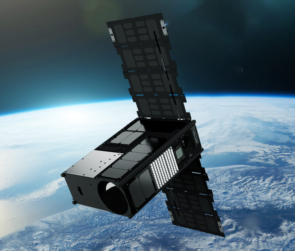
Wyvern’s vision is to gather actionable intelligence from space anywhere in the solar system to enable a sustainable future for humanity. The company plans to achieve this vision by creating a constellation of satellites that provide valuable data and insights for a wide range of industries. In April 2023, Wyvern will launch its first-generation cube satellites, starting with Dragonette-001.
Dragonette-001 is a hyperspectral satellite that will provide valuable data for agriculture, environmental monitoring, and a variety of other industries. Hyperspectral imaging captures information from a wide range of the electromagnetic spectrum and breaks it up into fine slices, allowing for enhanced spectral detail.
Dragonette-001 can capture data from 23 bands at a 5.3-meter pixel resolution, which enables the detection of subtle differences in the spectral signature of various materials. This ability to see finer details within the electromagnetic spectrum will allow Wyvern’s customers to identify and classify objects on the ground.
The launch of Dragonette-001 represents a significant achievement for Wyvern. It is the first of many satellites in Wyvern’s planned constellation of space-bound hyperspectral sensors. Dragonette-002 and Dragonette-003 will follow suit in 2023, providing even more detail through their increased sensing ability. Wyvern is also developing a deployable telescope that stows compactly on launch and unfolds once in space. This unfolding design allows for better performance in a smaller, cheaper-to-launch package.
Wyvern’s goal is to push the boundaries of what’s possible in the geospatial industry while training the next generation of Canada’s space workforce in Alberta. The company is proud to be at the forefront of hyperspectral imaging technology and to provide valuable data and insights to a wide range of industries.
Dragonette-001 is just the beginning of Wyvern’s journey, and it is excited to continue developing technologies that will capture even better imagery from space to enable new solutions to real-world problems.
“In 5 years, we will have a constellation of satellites in space, in 10 years, we will be the go-to provider of hyperspectral imagery on Earth, and in 30 years we will be a go-to provider of Earth insights from space.” – Chris Robson, CEO

Our Data Specifications
Wyvern hyperspectral sensors on our Dragonette satellites will capture data across many narrow spectral bands, allowing for the specific identification of unique chemical and physical properties of the Earth’s surface. This ability makes hyperspectral imagery a valuable tool for a wide range of site monitoring, mapping, and geospatial intelligence (GEOINT) use-case applications.
With a spatial resolution of 5.3 meters, hyperspectral imagery delivered from our Dragonette constellation will provide detailed information about the Earth’s surface. Processed to Level 1B and delivered in GeoTIFF format, we ensure seamless integration of Wyvern’s Dragonette data into your existing systems, workflows, and processes.
Want To Learn More?
Explore the wonders of our first-generation satellites! Delve into our Generation One page for in-depth insights into Dragonette-001, -002, and -003. Uncover the remarkable world of our pioneering satellite technology.
Contact Us
If you’re eager to delve deeper into the realm of hyperspectral data or have any questions about how it can revolutionize your industry, we’re here to assist you. Our team of experts is equipped with extensive knowledge and experience in harnessing the power of hyperspectral technology.