Celebrating Earth Day at Wyvern
As we celebrate Earth Day, it’s a time to reflect on the importance of preserving our planet and the ways that we are helping us achieve this goal. At Wyvern, we are proud to be using our hyperspectral data to monitor and protect our environment from space. Here are some ways that our hyperspectral data is helping create a better earth, from space.
Wildfire Management and Forest Health
Hyperspectral imaging can offer higher accuracy speciation, so we can identify different tree species, as well as use the data to monitor their health. Hyperspectral data also enables early detection of biotic damage agents, such as pine beetles, allowing for timely interventions that can prevent widespread infestations. For forestry companies, hyperspectral imaging provides insights into reforestation efforts and overall forest health. By monitoring the growth and health of newly planted trees, we can ensure that reforestation projects are successful and sustainable. This not only supports the recovery of damaged ecosystems but also contributes to carbon capture, helping to fight climate change.
Water Quality and Coastal Ecosystems
High-accuracy bathymetry can be dervied from Wyvern’s data, which allows us to map the topography of coastal waters. This information is crucial for monitoring changes in coastal ecosystems, such as coral reefs and seagrass beds, which are essential for marine biodiversity and coastal protection. By keeping a close eye on these ecosystems, we can detect early signs of degradation and take action to protect them. This can include monitoring the impact of human activity on reefs, identifying sources of pollution, tracking the impact of climate change, and supporting conservation efforts to protect these fragile environments.
Sustainable Agriculture
Hyperspectral data enables more accurate monitoring of crop health and nutrient requirements, allowing farmers to optimize fertilizer usage. This reduces excess runoff into water bodies, which can cause harmful algae blooms and degrade water quality. By providing information on plant stress, our data can help farmers manage drought conditions more effectively. This not only improves crop yields but also conserves water resources, making agriculture more sustainable and eco-friendly.
Monitoring Ecosystems
Our hyperspectral images can assist with monitoring ecosystems for the impacts of temperature fluctuations and variability in seasons due to climate change. Additionally, we can detect the presence of invasive species, which can disrupt ecosystems. Early detection allows for timely interventions, preventing the spread of invasive species and protecting our ecosystems!
Annual Wyvern Community Clean Up
At Wyvern, our commitment to the environment goes beyond the data we provide. Each year, our team rolls up their sleeves to take part in local clean-up efforts around our Edmonton headquarters because we believe meaningful change begins in our own backyard.
And it’s not just our HQ team—our remote employees also take the initiative to clean up their own neighbourhoods, showing that no matter where we are, we’re united in creating a cleaner, more sustainable future.
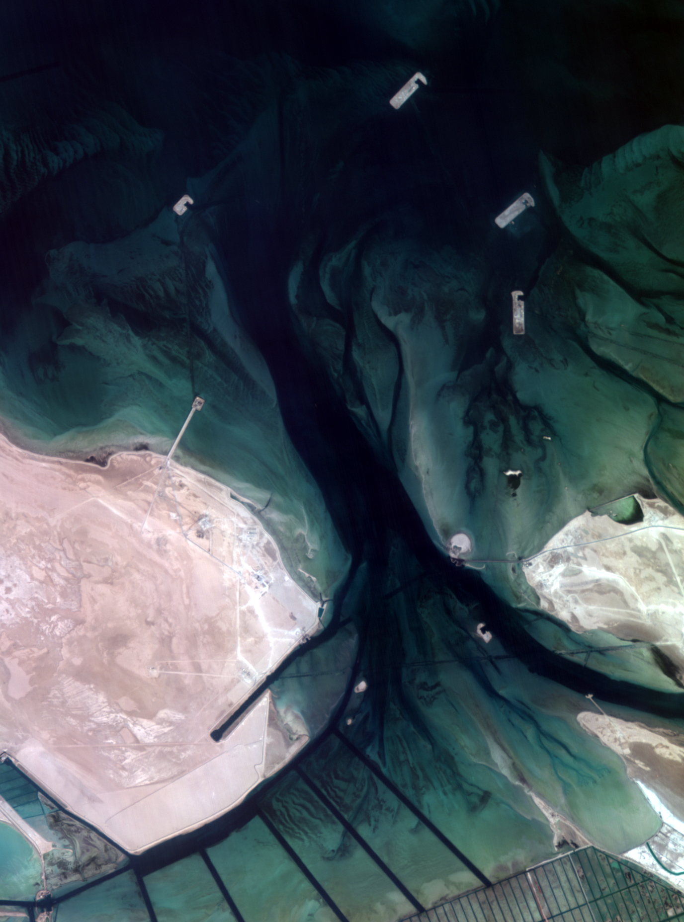
Dragonette-001 image near Abu Dhabi taken on 2024-11-07 6:07:00 UTC. Available in our Open Data Program here.
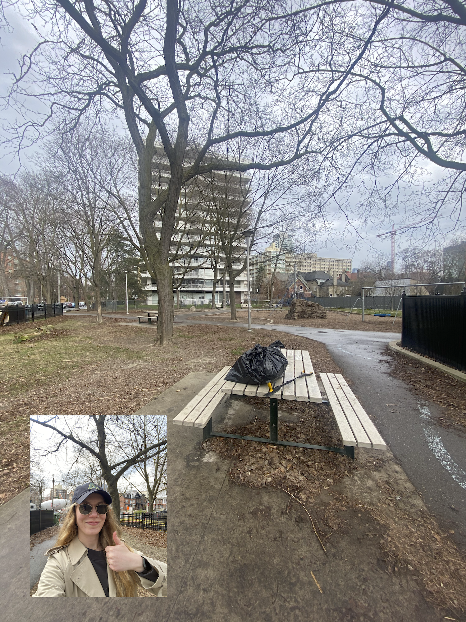
Our CTO Kristen cleaning up her local park.
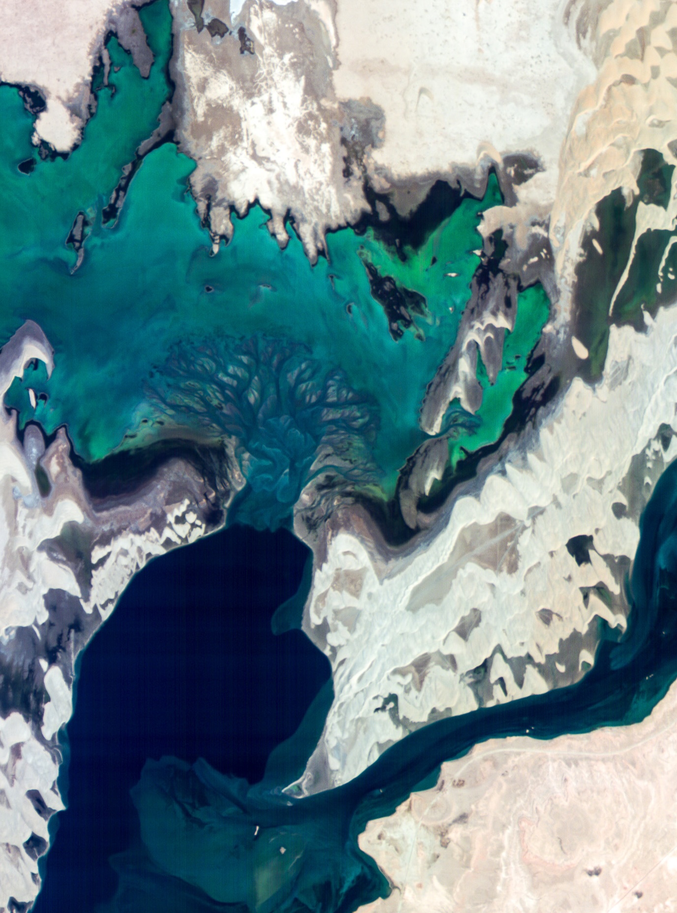
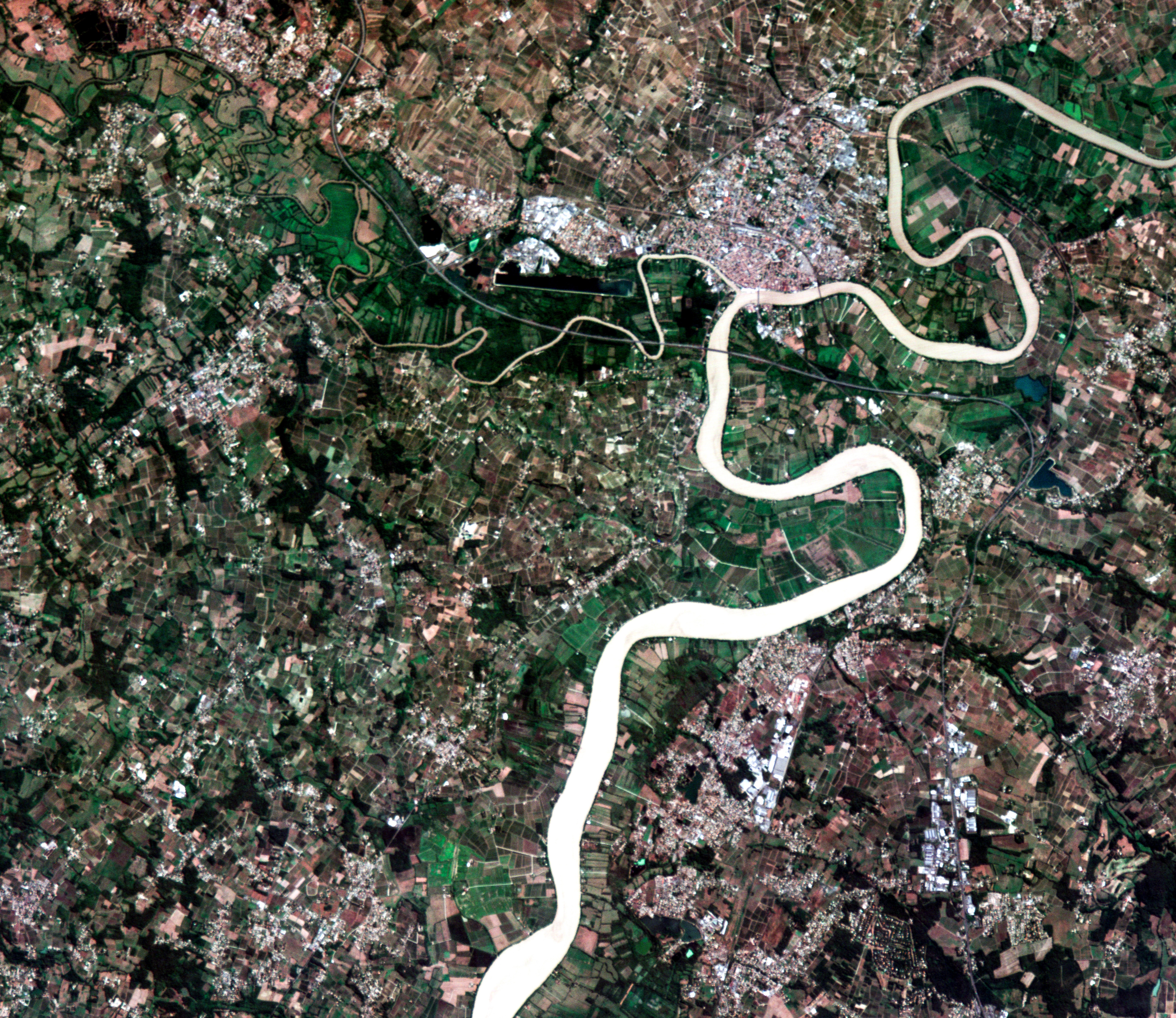
Dragonette-001 image over Qatar taken on
2024-09-03 20:11:13 UTC.
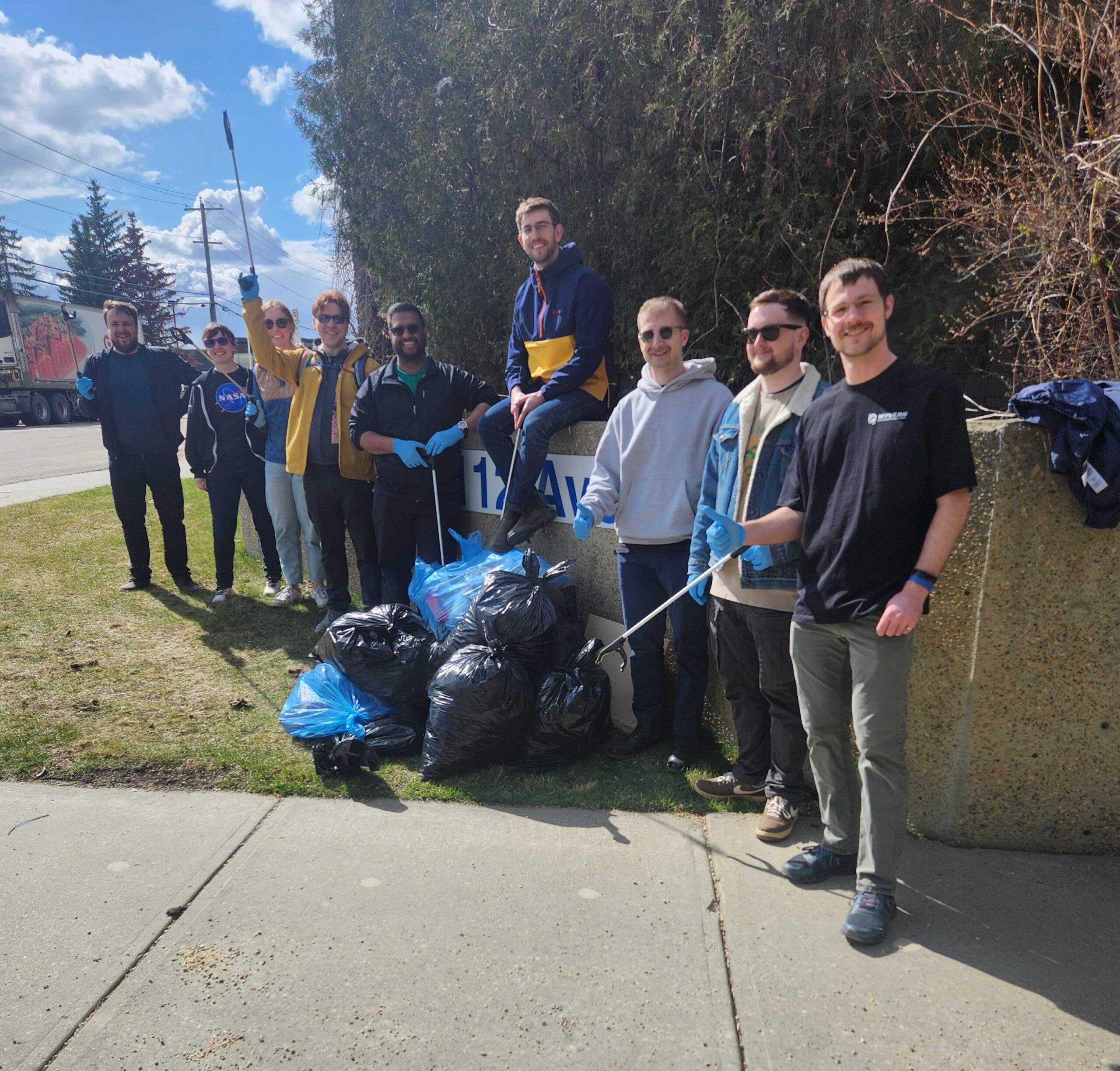
Wyvernians (L-R: Harrison, Taylor, Geneva, Peter, Shiva, David, Elliot, Brandon, and Andre) at our Edmonton HQ cleaning up the local community.
Dragonette-001 image over vineyards near Bordeaux, France taken on
2024-08-22 09:30:38 UTC.
Contact Us
If you’re eager to delve deeper into the realm of hyperspectral data or have any questions about how it can revolutionize your industry, we’re here to assist you. Our team of experts is equipped with extensive knowledge and experience in harnessing the power of hyperspectral technology.