Empowering Forestry With Hyperspectral
Wyvern is the way decision makers address the world’s biggest challenges. Our hyperspectral data reveals the hidden reality of planet Earth.
Empowering Forestry With Hyperspectral
Wyvern is the way decision makers address the world’s biggest challenges. Our hyperspectral data reveals the hidden reality of planet Earth.
Forestry Use Cases
Inventory Management
Enhance forest modeling capabilities, optimize harvest operational efficiency, and more.
Invasive Species Detection
Enhance crop inventory accuracy through advanced technologies and data-driven approaches, ensuring more precise and reliable assessments.
Wildfire Monitoring
Enhance the accuracy of wildfire predictions through advanced data analysis and modeling techniques, enabling more effective resource allocation for firefighting efforts.
Hyperspectral Indices For Forestry
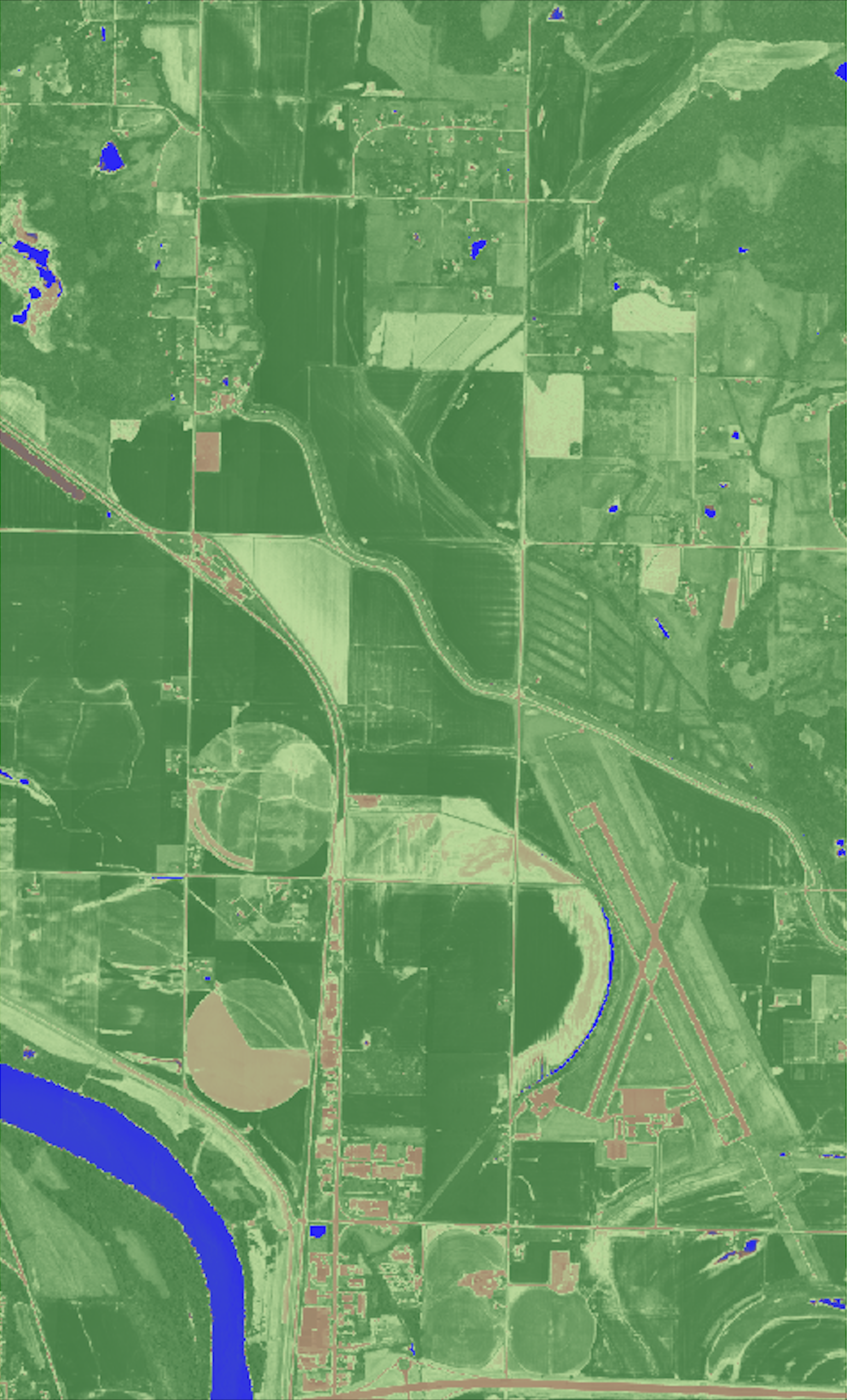
Index 1: RENDVI
The Red Edge Normalized Difference Vegetation Index detects slight changes in the sensitivity of vegetation to examine changes in foliage and senescene—useful in vegetation stress detection.
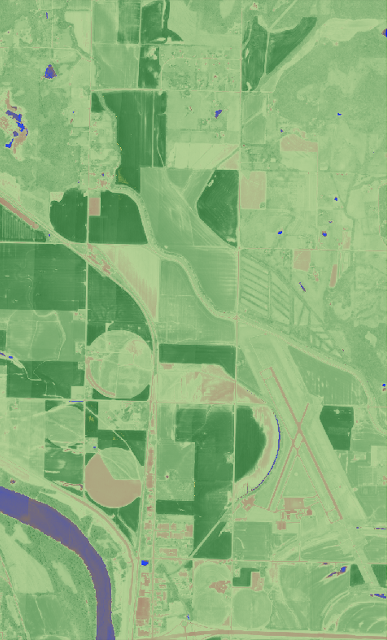
Index 2: VREI2
Vogelmann Red Edge Index is sensitive to the combined effects of foliage chlorophyll concentration, leaf area, and water content—clearly highlights soils and water.
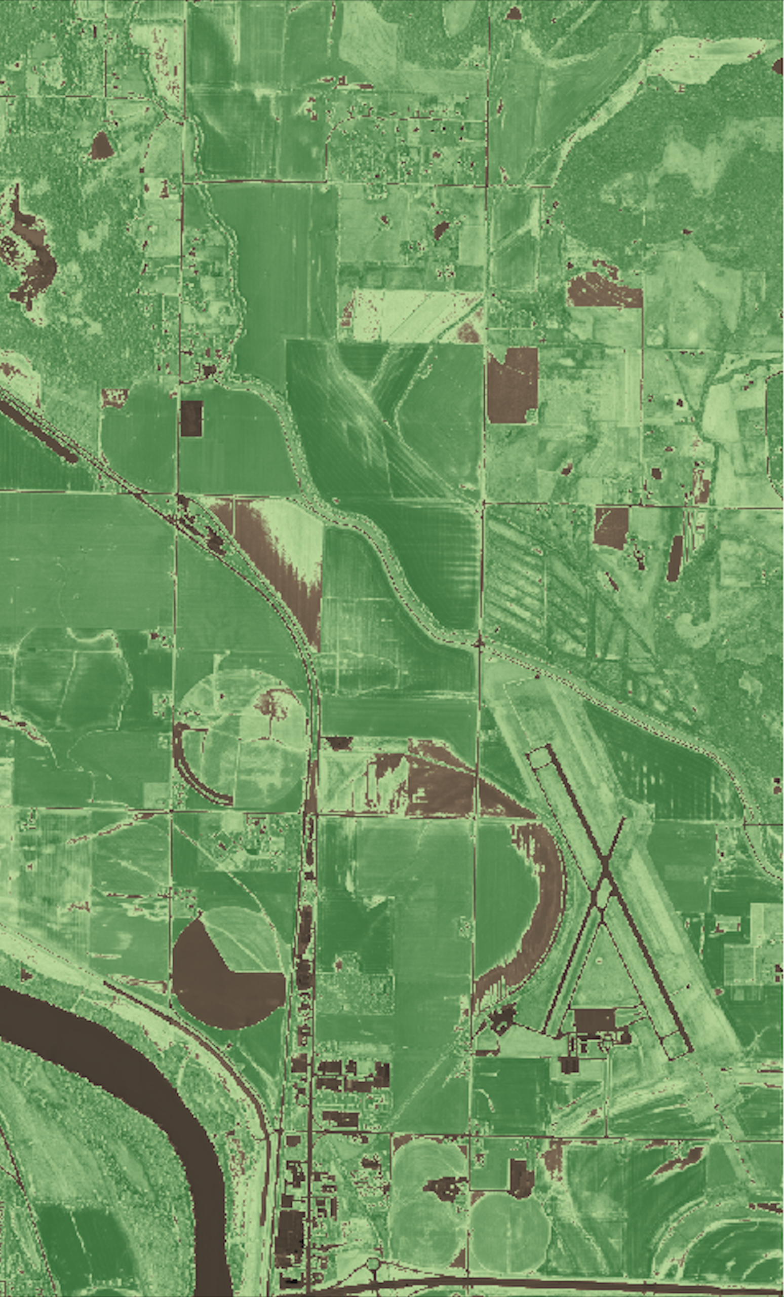
Index 3: MCARI2
Modified Chlorophyll Absorption In Reflectance Index 2 minimizes the need for extensive soil sampling by utilizing advanced techniques, resulting in reduced sampling hours in the field while simultaneously improving accuracy.
Request A Data Sheet
Wyvern hyperspectral sensors on our Dragonette satellites will capture data across many narrow spectral bands, allowing for the specific identification of unique chemical and physical properties of the Earth’s surface. This ability makes hyperspectral imagery a valuable tool for a wide range of site monitoring, mapping, and geospatial intelligence (GEOINT) use-case applications.
With a spatial resolution of 5.3 meters, hyperspectral imagery delivered from our Dragonette constellation will provide detailed information about the Earth’s surface. Processed to Level 1B and delivered in GeoTIFF format, we ensure seamless integration of Wyvern’s Dragonette data into your existing systems, workflows, and processes.
Contact Us
If you’re eager to delve deeper into the realm of hyperspectral data or have any questions about how it can revolutionize your industry, we’re here to assist you. Our team of experts is equipped with extensive knowledge and experience in harnessing the power of hyperspectral technology.